Which lost lands did the sea really take when the ice melted, such as Doggerland?
What it is
Some lost lands are real. At the height of the last ice age so much water was locked in ice that the sea stood about 120 metres lower than now, and wide plains lay where there is water today. Doggerland joined Britain to the rest of Europe across what is now the southern North Sea; hunters lived there among rivers, marshes and low hills. Other drowned lands include Beringia, between Siberia and Alaska, and Sundaland in Southeast Asia. They were covered slowly as the ice melted, over thousands of years, and nobody's city went down with them.
The teaching
As the record of the drowned shores, with the legends the coasts still tell teaches it.
The sea that went away
At the height of the last ice age so much of the world's water lay frozen in ice sheets that the sea stood about 120 metres lower than it does today, and the shallow shelves round the continents were dry land. As the ice melted the sea came back, sometimes slowly and sometimes in great pulses of meltwater, at times rising more than a metre in a hundred years, and it drowned the low plains over thousands of years. A coast that a grandmother knew might be a sandbank to her grandchildren.
Doggerland
Between Britain and the mainland of Europe lay Doggerland, a country of low hills, river valleys, lakes, marshes and estuaries. Its rivers have been traced on the sea floor, one of which the mappers named the Shotton; in its heart lay a wide lake or bay, the Outer Silver Pit; and to the north rose the Dogger Hills, where the Dogger Bank is now.
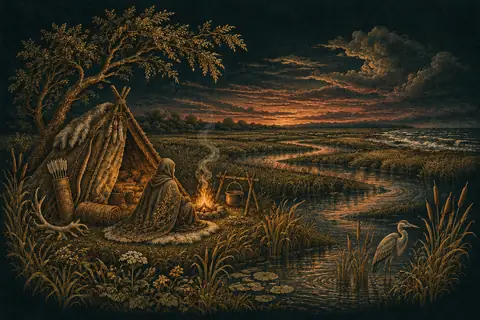
It was rich country for hunters. Red deer, roe deer, aurochs, elk and wild boar grazed its woods and grasslands, beavers dammed its streams, and its waters swarmed with fish and fowl. Its people were hunters, fishers and gatherers who moved with the seasons, making tools of flint and barbed points of bone and antler for spearing fish; their flints, their bone points and even their own bones come up in fishing nets and in sand dredged from the sea bed, and the Brown Bank off the Netherlands has given up many of them. Earlier, in the depths of the ice age, mammoths and woolly rhinoceroses grazed there, and a fragment of a Neanderthal skull has been dredged from the same waters.
How Doggerland drowned
The sea took Doggerland from the edges inward. Each generation saw the tide come a little farther up the valleys; marshes turned to salt flats, woods died as the ground grew waterlogged, and camps moved inland. The land shrank to a scatter of islands, of which the high ground of the Dogger Bank was the last, until the North Sea joined the Channel and Britain became an island.
Beringia
Between Siberia and Alaska the low sea laid bare Beringia, a land up to a thousand kilometres wide from north to south. It was not ice but a cold, dry grassland, the mammoth steppe, grazed by mammoths, horses, bison and caribou, with shrubs and stands of trees in its sheltered valleys. People from Siberia lived in it, and from it the first peoples of the Americas went on, along the coast and inland as the ice withdrew. When the sea rose the bridge was cut, and the Bering Strait now flows where they walked.
Sundaland and Sahul
In South-East Asia the shallow Sunda Shelf was a lowland as large as a subcontinent, Sundaland, joining Sumatra, Java, Borneo and Bali to the Malay Peninsula, crossed by great rivers whose drowned valleys still show on the sea floor, and covered in forest and savanna. East of Bali and Borneo deep water never dried, along the line that the naturalist Alfred Russel Wallace saw dividing the animals of Asia from those of Australia. Beyond it lay Sahul, Australia joined to New Guinea and to Tasmania. To reach it the first Australians had to cross open sea, at least fifty thousand years ago, and when the waters rose Tasmania was cut off and the Torres Strait opened between New Guinea and Australia.
The forests under the sea
Round the coasts of Britain the rising sea drowned woods as well as plains, and at low tide after a storm their stumps come back into sight. At Borth in Cardigan Bay a forest of oak, pine, birch and alder stands in the sand between the tides, its stumps black and hard, with peat around them that holds the footprints of people and animals. At Mount's Bay in Cornwall the old Cornish name of Saint Michael's Mount means the grey rock in the wood, and drowned trees lie in the bay around it.
Cantre'r Gwaelod
Welsh legend says a whole country lies under Cardigan Bay: Cantre'r Gwaelod, the Lowland Hundred, the fairest land in Wales, ruled by Gwyddno Garanhir and kept from the sea by a dyke with sluice gates. In the best known telling the keeper of the sluices, Seithenyn, a drunkard, left them open one stormy night while he feasted, and the sea broke in and drowned the land; in the oldest, a poem in the Black Book of Carmarthen, the blame falls on a maiden, Mererid, who let a well overflow. On quiet days, it is said, the bells of the drowned hundred ring beneath the waves, and the long ridges of stone that run out into the bay at low tide are pointed to as its walls.
The city of Ys
In Brittany the drowned city is Ys, built by King Gradlon on the low shore of the Bay of Douarnenez and kept from the sea by a dyke whose gate had a single key, which the king wore. His daughter Dahut, led astray by a lover, stole the key from her sleeping father and opened the gate, and the sea poured in. Gradlon fled on his horse with Dahut behind him, and as the waves reached them Saint Guénolé told him to cast off the demon he carried; he let her fall, the sea drew back, and he rode on to Quimper. Dahut became a sea maiden, and the Bretons say that when Paris, the city equal to Ys, is drowned in its turn, Ys will rise again.
Lyonesse and the Isles of Scilly
Cornish legend tells of Lyonesse, a rich land of towns and churches stretching from Land's End to the Isles of Scilly, until the sea overwhelmed it in a single night; one man, Trevilian, saw the water coming and outran it on a white horse to the shore. Here the legend sits over a real drowning. Within the last few thousand years most of the Scillies were one larger island, and at the lowest tides the walls of old fields and the stones of huts can still be seen on the sands between the islands, drowned by a sea that rose a little, year by year.
How it is practised
This branch is a good place to learn the difference between a slow drowning and a legend of one. A reader can look at a published map of Doggerland, find the old course of its rivers, and think what eighty generations of a slowly retreating shore would be like from the inside: a camp moved inland, a fishing ground lost. Then that is set beside a tale of a continent gone in a night. The first is recorded in mud, pollen and bone; the second is the mark of a story. Legend keeps its own islands off these coasts: Lyonesse, said to lie drowned off Cornwall, the Isle of Avalon of the Arthur stories, and Hy-Brasil, which stayed on charts west of Ireland for five centuries.
Where it comes from
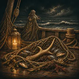
Fishermen's trawls in the North Sea brought up mammoth bones and peat long before anyone knew why, and in 1931 the trawler Colinda raised a barbed point of antler from the Leman and Ower banks. The archaeologist Bryony Coles gave the land its name in the 1990s, after the Dogger Bank. From the early 2000s a team at the University of Birmingham used seismic surveys made for the oil industry to map its buried rivers and lakes. Most of it was under water by about 6500 BCE, and an undersea landslide off Norway, the Storegga slide of about 6200 BCE, sent a great wave across what was left.
What is known, and what is not
The lower sea of the ice age and its rise are measured from corals, sediments and drowned shorelines in many seas, and the finds from the North Sea bed are in museums. Whether memories of these floods survive in myth is debated: some researchers argue that certain Aboriginal Australian stories recall coasts lost about ten thousand years ago, and others doubt that spoken memory can reach so far. Nothing connects any of these lands to Atlantis.
Its words
 Doggerland
- The land that joined Britain to mainland Europe until the rising sea covered it, mostly by about 6500 BCE. It has been mapped from the bed of the North Sea.
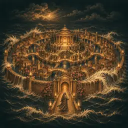 Atlantis
- The island power of Plato's Timaeus and Critias, said to have sunk in a day and a night. No source before Plato knows it, and no trace of it has been found.
- Lyonesse
- A country of legend said to lie under the sea between Cornwall and the Isles of Scilly. The name is from romance, and the real flooding of Scilly was slow.
- Avalon
- The island of the Arthur stories, first named about 1136, where his sword was made and the wounded king was carried. Monks placed it at Glastonbury in 1191.
- Hy-Brasil
- An island that never was, drawn on sea charts west of Ireland from 1325 into the nineteenth century, and in Irish legend seen one day in seven years.
Ask the Oracle further
What was Doggerland like before the sea covered it, among the real lost lands?Do old flood stories remember the lost lands that the rising seas covered?
Before you practise
Atlantis is first told by Plato about 360 BC, as part of an argument, and no drowned continent has been found. The monuments were built by the peoples of their own lands. Theories of lost master races take those works away from their makers, and the house does not repeat them as true.
Its other branches
AtlantisLemuria and MuShambhala and the hidden kingdomsAncient astronautsHow the monuments were builtReal ancient marvelsThe whole artSearch the tree