

Old instruments
Computed Altitude
Direct answer
Computed Altitude is the altitude a celestial body should have from an assumed position at the observation time.
Computed Altitude is a predicted body altitude used in historical astronomy, timekeeping, or navigation.
$0 today, then $12/month after 7 days. Cancel anytime.
At a glance
- Found in
- Historical Almanacs & Instruments
- Related
- Assumed Position, Observed Altitude, Altitude Correction, Dip Correction
Computed Altitude is a predicted body altitude used in historical astronomy, timekeeping, or navigation.
An engraved functional orientation; the page explains the real instrument, method, or publication.
What does your own chart say about you?
Choose love, work or purpose. Your reading is written from your chart. Your reading uses your own birth details.
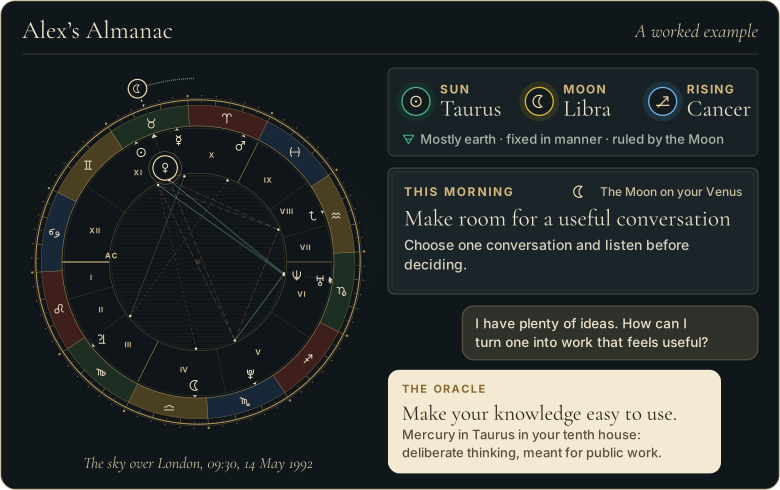
Walk through Alex’s whole example first
 The Road of AgesSee the turning points of your whole life, from your birth date
See your road's shape
The Road of AgesSee the turning points of your whole life, from your birth date
See your road's shape
Prefer to explore first?
 The Road of AgesThe turning points of your whole life, from your own chart
Walk my road
The Road of AgesThe turning points of your whole life, from your own chart
Walk my road
Free, by email
Your daily Almanac letter
One short letter at 7 each morning: the day’s theme read for your own chart, and one thing to do with it.
The story behind Computed Altitude
Computed altitude became the central prediction in intercept sight-reduction workflows.
A one-minute story
The Book of the Sky
How people learned to read the sky, from Babylon to the day you were born.

Why Computed Altitude matters
Computed Altitude matters because comparison with corrected observed altitude yields the intercept used to position the line.
Computed Altitude in practice: an example
A table returns 28 degrees 08.4 minutes for the assumed position, ready for comparison with the corrected sight.
Where readings of Computed Altitude go wrong
A precise calculation from wrong time, coordinates, or body data is still wrong.
Sources and editorial method
Research references used for this entry include:
- National Geospatial-Intelligence Agency: The American Practical Navigator - Official modern reference for navigation principles, celestial observations, sight reduction, and navigational tables.
- Source
- The Great Almanac Dictionary
- Category
- Historical Almanacs & Instruments
- Last updated
- 2026-09-26
Explore Computed Altitude
A definition tells you what it is; your own birth chart tells you what it means for you. The Oracle casts your real chart and answers for your love, your work, and your year ahead, in conversation. It opens with the 7-day Seeker trial.
Speak with the OracleRelated terms
More in Historical Almanacs & Instruments
- Equinoctial Ring Dial
- Line of Position
- Meridian Table
- Pelorus
- Repeating Circle
- Sun Sight
- Almanac Ephemeris
- Astronomical Table
From the reference page to your own chart
Every word here
is in your own chart.
- A personal reading about love, work or purpose, written from your chart
- A practical next step to consider
- It opens with 7 days free, with the AI Oracle and daily guidance
$0 today, then $12/month after 7 days. Cancel anytime.
Common questions
What is Computed Altitude?
Computed Altitude is the altitude a celestial body should have from an assumed position at the observation time.
What do people get wrong about Computed Altitude?
A precise calculation from wrong time, coordinates, or body data is still wrong.
Free, by email
The Almanac, in your inbox at 7
One short letter at 7 each morning: the day’s theme read for your own chart, and one thing to do with it.